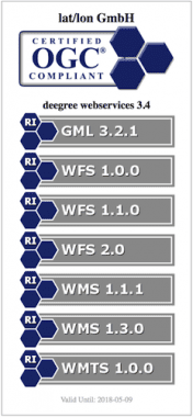
The deegree software is built on the standards of the Open Geospatial Consortium (OGC) and the ISO Technical Committee 211. It includes the OGC Web Map Service (WMS) reference implementation, a fully compliant Web Feature Service (WFS) as well as packages for Catalogue Service (CSW), Web Coverage Service (WCS), Web Processing Service (WPS) and Web Map Tile Service (WMTS). Since 2000 deegree has been developed by lat/lon, with the strong intention to make it a community-driven project. A major step to this effect was the acceptance to be an OSGeo project in 2010. Today, deegree is maintained by several organisations and individuals with a large user base all around the world.
Core features
-
Web Feature Services (WFS): Serves vector data from geospatial data
- Implements WFS standards 1.0.0, 1.1.0 and 2.0.0 (OGC Reference Implementation)
- Supports KVP, XML and SOAP requests
- GML 2/3.0/3.1/3.2 output/input
- Advanced filter expression support based on XPath 1.0
- Supports numerous backends, such as PostGIS, Oracle Spatial, MS SQL Server, Shapefiles or GML instance documents
-
Web Map Services (WMS): Serves maps rendered from geospatial data
- Implements WMS standards 1.1.1 and 1.3.0 (OGC Reference Implementation)
- Extensive support for styling languages SLD/SE versions 1.0.0 and 1.1.0
- Supports numerous backends, such as PostGIS, Oracle Spatial, Shapefiles or GML instance documents
- Raster formats such as PNG, GeoTIFF
-
Web Map Tile Services (WMTS): Serves pre-rendered map tiles
- Implements Basic WMTS standard 1.0.0 (OGC Reference Implementation)
- Supports different backends, such as GeoTIFF, remote WMS or file system tile image hierarchies
-
Catalogue Services for the Web (CSW): Performs searches for geospatial datasets and services
- Implements CSW standard 2.0.2
- Fully transactional
- Supports KVP, XML and SOAP requests
- ISO Metadata Application Profile 1.0.0
- Handles all defined queryable properties (for Dublin Core as well as ISO profile)
-
Web Processing Services (WPS): Executes geospatial processes
- Implements WPS standard 1.0.0
- Supports KVP, XML and SOAP requests
-
OGC GML 2.12, 3.0.1, 3.1.1 and 3.2.1
- OGC certified Reference Implementation for 3.2.1
Implemented Standards
- Catalogue Service for the Web (CSW)
- Filter Encoding (FE)
- Geography Markup Language (GML)
- Open Geospatial Consortium (OGC)
- Styled Layer Descriptor (SLD)
- Web Coverage Service (WCS)
- Web Feature Service (WFS)
Web Feature Service - Gazetteer Service
(WFS-G)- Web Feature Service - Transactional (WFS-T)
- Web Map Service (WMS)
- Web Map Tile Service (WMTS)
- Web Processing Service (WPS)


